
Searches for heavy snow are jumping again as fresh warnings pop up across the United States. If you live anywhere near mountains or the Great Lakes, today’s forecast deserves a close look.
Here’s a clear picture of where the snow is falling and what will happen next.
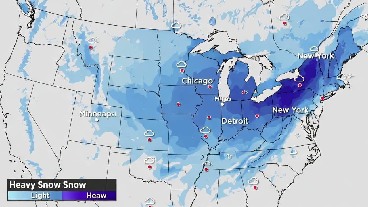
Northeast: Lake Effect Bands Keep Hammering New York
Northern parts of New York State are under intense lake effect snow, especially around Syracuse and Onondaga County. The National Weather Service warns that storm totals could reach around 5 to 9 inches in local bands.
More than half a million people in the region have been told to avoid travel where possible. Roads can turn slick very fast as squalls move through, so even short trips need extra time.
Areas just outside the core snow bands may only see light snow, but conditions can shift fast. If you must drive, keep your fuel tank topped up and carry warm clothes, food, and water.
Rockies, Utah, Alaska: Mountain Passes Facing Deep Snow
Higher elevations in Colorado, Wyoming, Utah, and Alaska are under winter storm or winter weather warnings today. Mountain areas in these states are forecast to pick up several more inches, with some peaks near a foot.
- Rabbit Ears Pass in Colorado and nearby ranges in Wyoming, remain difficult for drivers, with blowing snow cutting visibility.
- In southeast Alaska, routes near Haines and the Klondike Highway are seeing heavy snow rates and dangerous wind chills.
- Backcountry skiers and snowmobilers also face rising avalanche danger as new snow stacks on older, weak layers.
Anyone crossing these passes should treat the trip like a winter backcountry journey, not a normal highway drive.
West Coast: Sierra Nevada Bracing For Huge Totals
Out West, the focus is shifting toward a powerful series of Pacific storms lining up for next week. Forecasters expect multiple waves of heavy mountain snow across California, especially in the Sierra Nevada. Some high passes could see up to ten feet of snow over several days.
This burst of snow is important for California’s snowpack, which feeds a large share of the state’s water supply. Lower elevations along the coast will mainly see heavy rain, gusty winds, and possible flooding.
Travellers planning mountain drives or ski trips should expect chain controls, whiteouts, and periods of closed roads.
A Weird Winter Pattern Is Starting To Flip
This surge of heavy snow is part of a larger story about how this winter has behaved. For weeks, the East has shivered under harsh cold and repeated storms while the West stayed oddly warm.
Meteorologists link that split to a wavy jet stream and a disturbed polar vortex over the Arctic. Now, models suggest the pattern will ease, with the East turning milder and winter shifting back toward the West.
Scientists are still studying how a warming climate affects these wild winter swings.
What You Should Watch For Today
If you live in an area under a winter storm or lake effect warning, treat it seriously. Heavy snow rates can drop visibility to near 0 and turn minor errands into risky trips.
Right now, warnings or advisories stretch across parts of at least five states from Colorado to New York. In the South and lower Midwest, watch for ice, strong winds, and power outages from recent storms.
Simple Steps To Stay Ready
You do not need to panic, but a few small choices today can make a big difference.
- Check your local forecast from the National Weather Service or a trusted local station before you head out.
- Avoid non-essential travel during the heaviest snow, especially over passes or rural roads.
- Keep an emergency kit in your car with warm layers, snacks, water, and a phone charger.
- If you work from home, plan deliveries and errands around the worst of the storm window.
- Stay in touch with neighbors and relatives who may struggle with deep snow, especially older adults.
Heavy snow can be disruptive, but with a clear forecast and simple plans, you can stay ahead.